New Case Study added about combining drone aerial photographs with computer-generated buildings
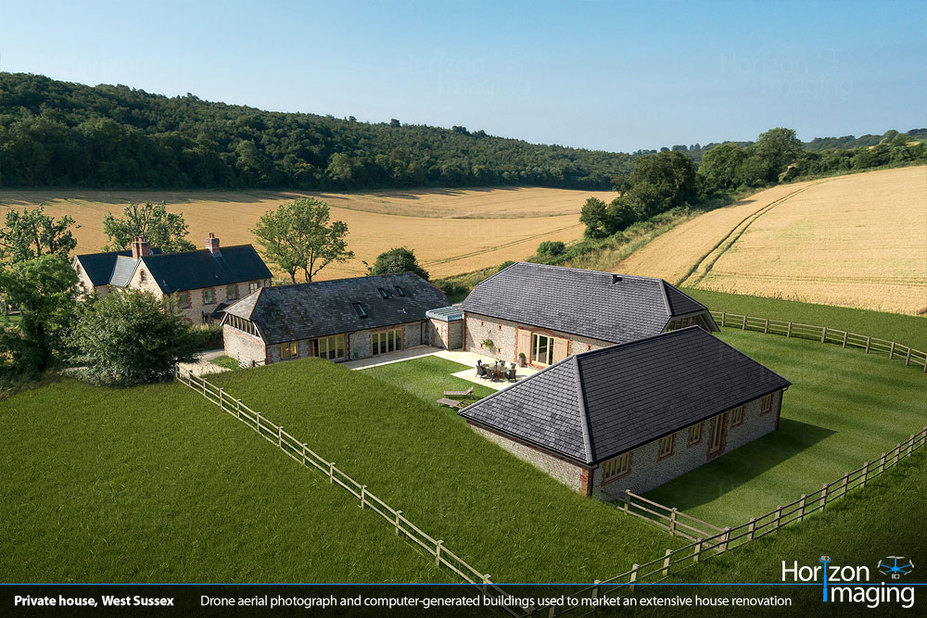
An increasingly popular use of drone aerial photographs is to combine them with computer-generated models of proposed developments — buildings which don’t even exist but can be rendered so realistically that it becomes hard to tell where the aerial photograph stops and the computer-generated model starts. This type of imagery is especially helpful during the planning phase of new developments and for estate agents, allowing them to market as-yet-unfinished properties using highly realistic imagery of the completed projects.
We have many years of experience working with property developers and 3D Visualisation Studios to do just this, and computer simulation software has become so advanced that it’s almost impossible to tell where reality ends and the computer models start. Want to know more? Read on …