


Drone Photography Services London
Serving London, and the south of the UK
Since we started designing and flying our own drones back in 2007 — or Unmanned Aerial Vehicles as they were then called — drones have exploded in popularity, and have brought fresh and exciting new perspectives to almost every sector of marketing.
- Is your marketing literature in need of a facelift ?
- Do you have projects that you're justifiably proud of, and you want to capture them with imagery that has a real wow factor ?
- Maybe the location of your site is one of its biggest assets and you are keen to showcase how the site sits in relation to its surroundings ?
- Looking to explore drone photography in London but concerned about navigating the regulations ?
Whatever your requirements, we’re here to help! Click the button to access our contact form where you can submit details of your requirements – We’ll be in touch soon!
Despite the popularity and affordable price point of modern drones, just like the advent of affordable Digital SLR cameras in the early 2000s, just because technology is affordable and accessible, it doesn’t mean whoever buys a drone suddenly knows how to use it to take beautiful and skilfully composed aerial photographs — we do, and our mission since 2007 has been to use drone technology to take the very best aerial photographs possible, using knowledge gained during 15+ years of operation and from capturing many hundreds of commercial projects, including numerous assignments in London.
What Makes Us Different?
Drones aren’t the unique photography platforms they used to be, and so having a drone is no longer the differentiator it once was (we custom-built our own drones in the late 2000s before they were commercially available, so back then, having a drone was already incredibly unique!). As such, it’s now how you use the drones and the overall experience of working with the service provider that really sets companies apart.
We’re very proud of our history and the journey we’ve been on – here are just some of the points we feel set us apart from other drone photography service providers:
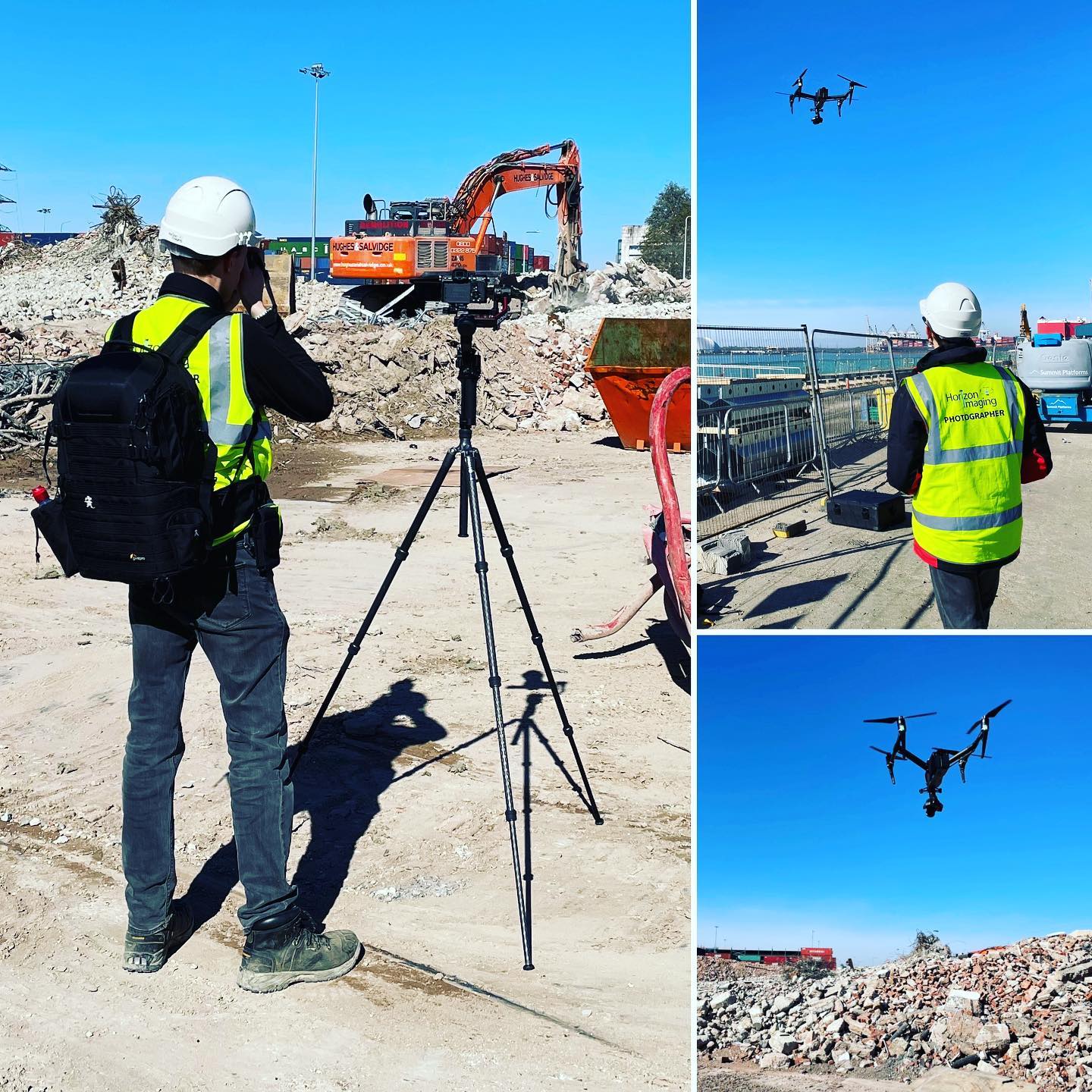
- Horizon Imaging was one of the first 50 operators (number #46) in the UK to be granted a CAA licence to undertake commercial work with drones back in 2010.
- We have over 15 years of experience in providing promotional imagery to the commercial property sector, so we know how to take photographs that have presence and impact. We bring this experience in commercial photography to our use of drones.
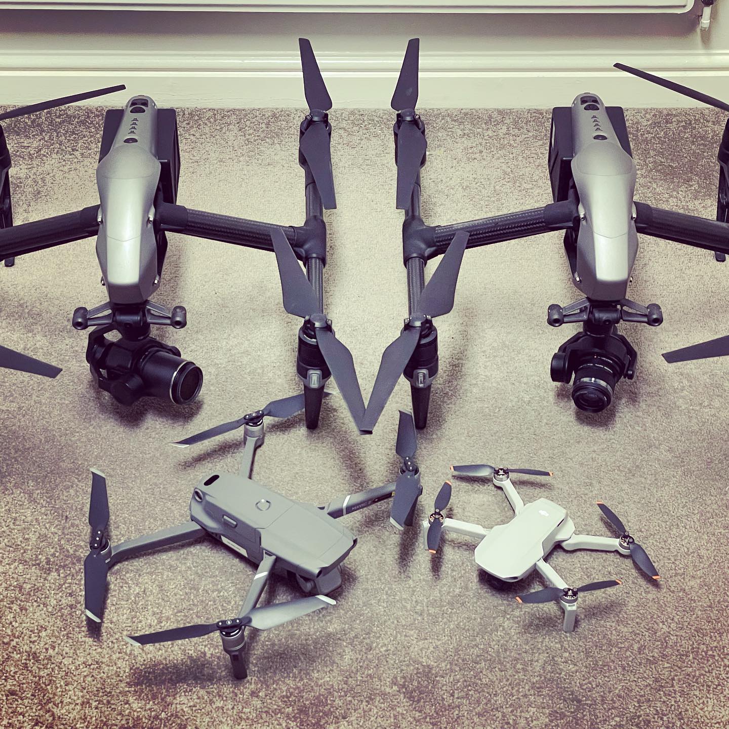
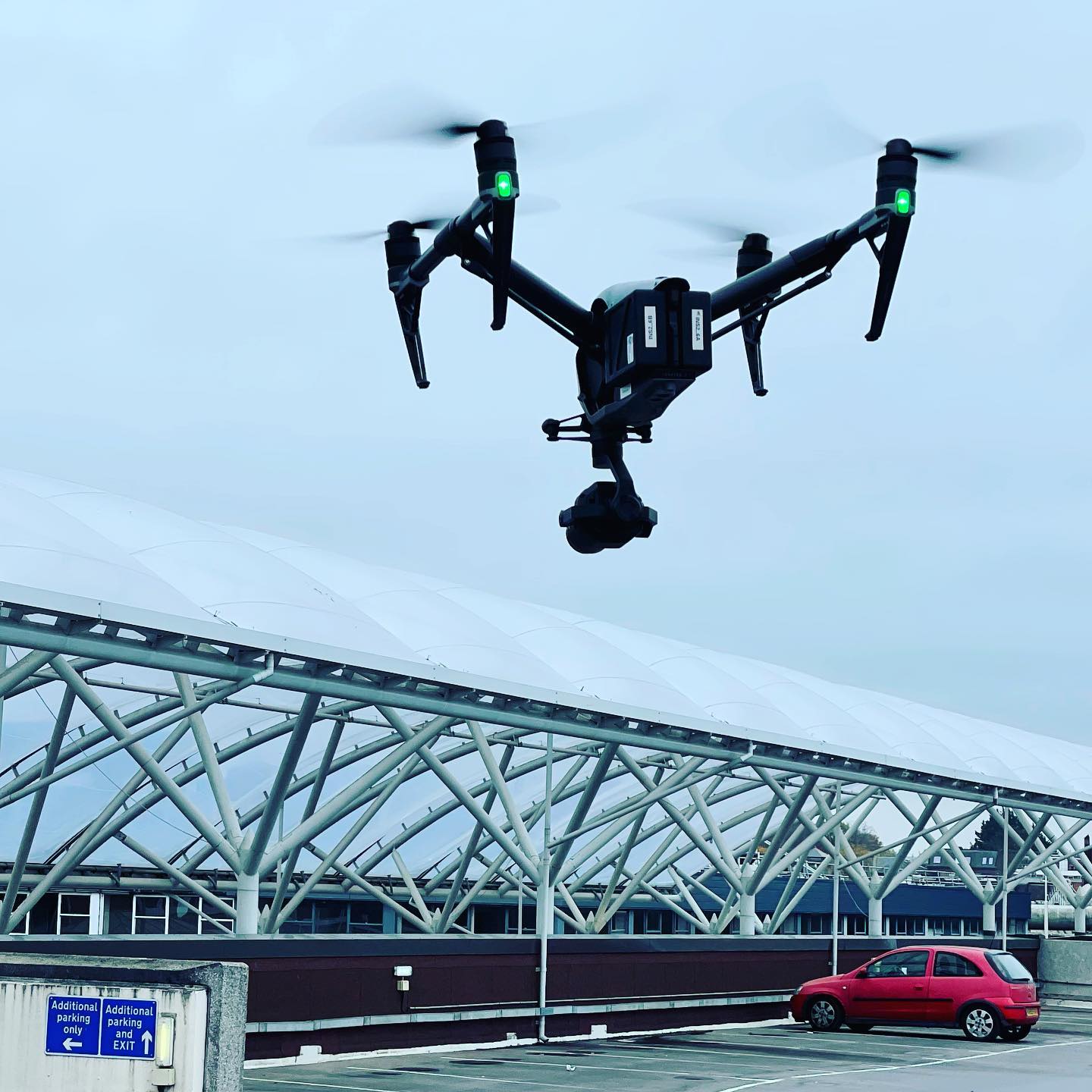
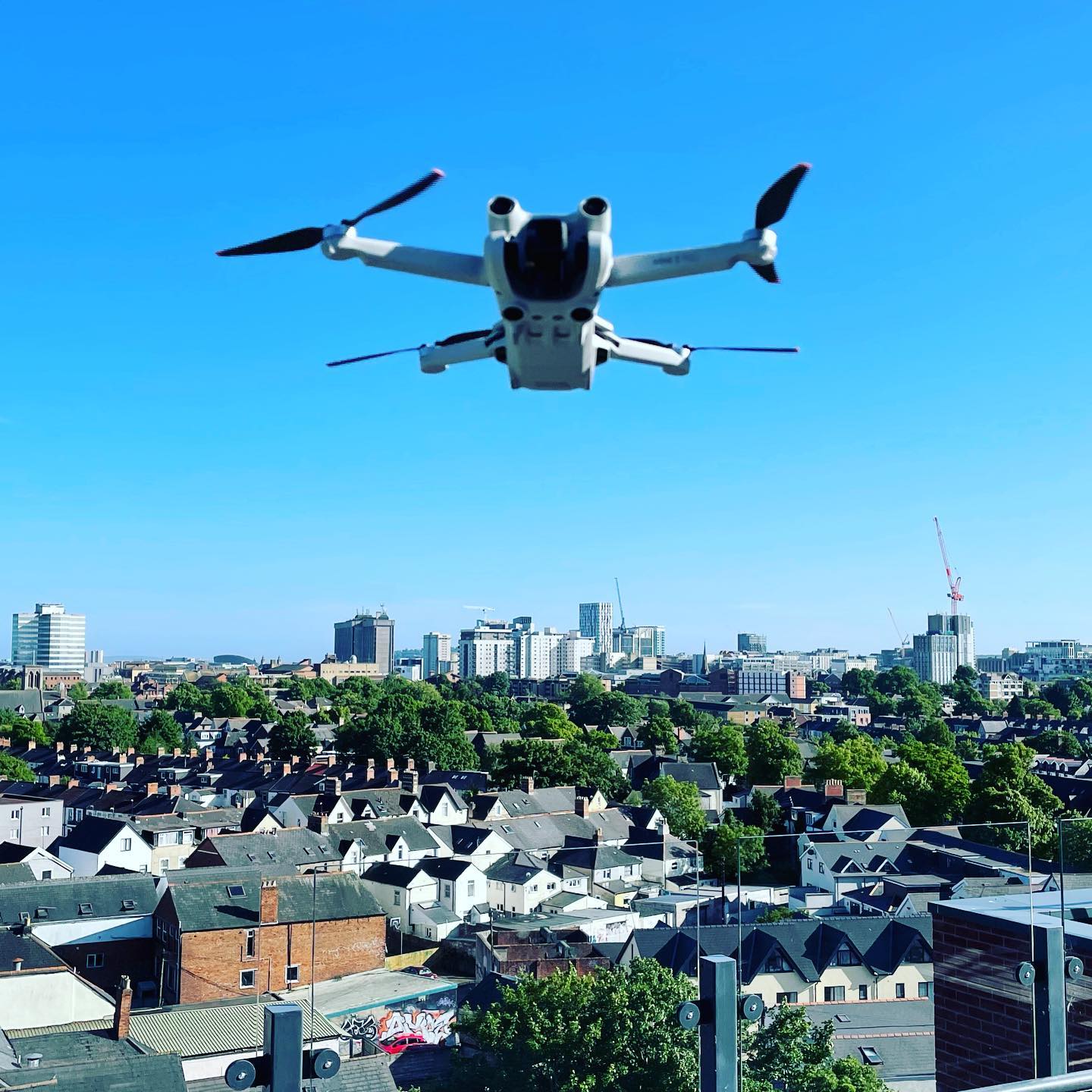
- We have a fleet of different size drones, each with their own capabilities, allowing us to choose the most appropriate drone for our clients' projects, which is especially important in a city like London.
- We bring a complete backup drone system to every shoot, ensuring that whatever happens, your imagery will get captured.
- We have 200+ glowing testimonials from our valued clients – a testament to our dedication to customer satisfaction.
Frequently Asked Questions – Drone Photography Services
We get asked numerous questions about drones, especially regarding the regulations and where they can be flown. So to save you asking, here are our most frequently asked questions about our Drone Photography Services. Click on a question to reveal the answer.
Yes, the Civil Aviation Authority has strict regulations on where drones can be flown.
However, these regulations do vary depending on a number of factors including the weight of the drone, the environment where it is to be flown, and if there are any significant hazards nearby such as airports – to name a few.
It is technically possible to fly any drone almost anywhere, provided the correct permissions and risk-mitigating strategies are put in place in advance, but very often there is a type of drone that is most suited to a particular job, depending on the final use case of the imagery (eg. website, print, TV, etc).
As such, we have a range of different drones for use in different situations, and we will always discuss how you wish to use the final imagery in order to select the optimum drone for your project and keep costs as low as possible. For example, using a huge cinema-quality drone for capturing images of a project that will only ever be used on a website at 1000 pixels across would be unnecessarily complicated and expensive.
Yes. Horizon Imaging has held the relevant permissions for undertaking complex drone operations with drones up to 7kg in weight since the regulations were introduced in 2010.
Following on from the answer to question 1, this is determined by a number of factors, specifically the weight of the drone being flown and also whether the people are ‘involved’ with the drone operations.
Members of the public who have no knowledge / awareness of the drone operations would be considered ‘uninvolved’, and so in this case, only drones under 250 grams in weight are permitted to fly over them.
If the people are aware of the drone operations (eg. they have been informed about where the drone will be flying) and are within earshot of the pilot so they can be told to move out of the way of the drone in an emergency, then they are considered ‘involved’ which means heavier drones up to 7kg in weight can fly over them.
But as a rule we always avoid flying over people if at all possible, even if technically we are allowed to do so.
As per the answers to questions 1 and 3, this also depends on the weight of the drone being flown as there will almost always be members of the public walking around built-up areas.
So, if the area is full of ‘uninvolved’ people, then only sub-250 gram drones can fly over the area.
If, however, a certain segment of the built-up area can been cordoned off so the operator can be sure that no uninvolved people will enter this area, then it’s possible to overfly the area with heavier drones.
Similarly, referring again to the answer to question 3, if a heavier drone needs to overfly people who can be considered ‘involved’ with the work, then provided they are within earshot of the operator in case of an emergency, heavier drones can overfly them.
Provided the relevant permissions have been put in place with the airport before the flight commences, generally yes flying close to, or even within an airport is not an issue.
However, depending on exactly where and when the drone is to be flown, the airport might stipulate a maximum altitude above ground level that the drone must not exceed, and such restrictions are non-negotiable.
Again, referring to the answer to question 1, obtaining permission to fly close to airports is handled entirely by us, so our clients don’t need to get involved.
We are limited by the CAA regulations to fly no higher than 400 feet (120 metres) above the ground.
This might sound restrictive, but often only a small increase in altitude will yield a dramatically different viewpoint, and photographs taken from 400 feet can capture a surprisingly large area of land.
We are limited by the CAA regulations to fly no further than 500 metres horizontally from the drone operator, but with the caveat that the operator must be able to maintain orientation of the drone at all times (they have to be able to see which way the drone is pointing).
Due to the difficulty of judging a drone’s orientation at a distance, for smaller drones this means flying the drone no further than approximately 150-200 metres from the operator.
The drone has to remain within line-of-sight of the pilot at all times, regardless of how far away it is flown, eg. it cannot be flown behind walls or too low over a roof if a suitable vantage point cannot be found for the pilot so they can maintain visibility of the drone.
Our drones can typically fly for approximately 25 minutes per battery before they have to land. We bring multiple sets of batteries to every shoot, and battery chargers can also be brought which would allow the drones to fly almost continuously all day.
All the drones we fly transmit a live video feed to a screen on the ground which allows the operator and client to compose the imagery in real-time before the camera is triggered.
No. Wind speeds gusting over 25-30mph will reduce the stability of the drone, and the resulting photographs / videos may suffer as a result.
Rain would also prevent a flight from taking place, partly because the onboard electronics are not waterproof / protected from the elements, but mostly because the resulting photographs / videos would look very dull.
The decision whether or not to fly the drone on the day of a shoot ultimately rests with the operator and their decision is non-negotiable.
This depends on the drone we are using. Our smallest drone that we use for roof inspections produces 12 megapixel images (4ooo pixels across), but our other drones deliver images that are 24 megapixels (6000 pixels across).
Understanding drone photography regulations in London
In London, drone photography is subject to specific regulations to ensure safety and privacy. As experienced operators, we are fully compliant with the UK’s Civil Aviation Authority (CAA) regulations. We ensure that all our drone operations in London, whether it’s capturing the bustling cityscape or serene parks, adhere to these rules. This includes obtaining necessary permissions for flying in congested areas and respecting no-fly zones. Our expertise in navigating these regulations means you can trust us to deliver exceptional drone photography while maintaining the highest standards of safety and legality.
Additional Applications For Drone Photography Services
Everyone knows that drones can be used to take photographs from the air. But there are more applications of that aerial imagery than you might imagine. Below are some of the extra applications that we have provided for our clients in the past, and we’re always open to exploring new ways to use this technology, so if you have any ideas please do get in touch!
360° Spherical Aerial Panoramas
These fascinating spherical aerial panoramas are produced by capturing imagery looking in all directions whilst the drone is hovering in the air.
The images are then stitched together and can even be annotated with hovering information points to highlight certain features visible in the landscape.
360° aerial panoramas are a great interactive tool to have on your website to show how your site sits within the surrounding landscape, or to show where nearby points of interest are in relation to your site.
Click the image on the right to immerse yourself in a 360° aerial panorama!
360° Spherical Aerial Panoramas
These fascinating spherical aerial panoramas are produced by capturing imagery looking in all directions whilst the drone is hovering in the air.
The images are then stitched together and can even be annotated with hovering information points to highlight certain features visible in the landscape.
360° aerial panoramas are a great interactive tool to have on your website to show how your site sits within the surrounding landscape, or to show where nearby points of interest are in relation to your site.
Click the image below to immerse yourself in a 360° spherical aerial panorama!
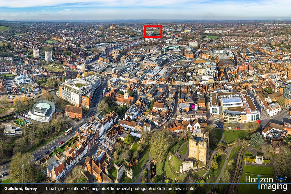
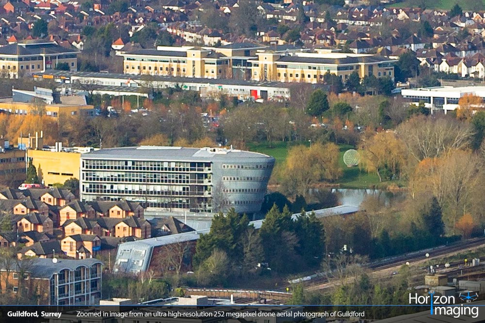
Ultra High-Resolution Aerial Photographs
Using a similar technique of image stitching, it’s also possible to create ultra high-resolution aerial photographs, such as the image on the right. This is actually composed of 21 separate 24 megapixel images, all taken from the same point in space and then stitched together. This process creates a resulting image which has a much higher resolution image than a single image — in this case it’s created a 252 megapixel image!
Press one of the arrow keys on the image on the right to see the zoomed image!
Ultra high-resolution aerial photographs allow for enormous prints to be made, or for interactive online images to be created where you can pan and zoom around to look at any part of the image in high-resolution detail (see the section above on 360° Spherical Aerial Panoramas).
Ultra High-Resolution Aerial Photographs
Using a similar technique of image stitching, it’s also possible to create ultra high-resolution aerial photographs, such as the image on the right. This is actually composed of 21 separate 24 megapixel images, all taken from the same point in space and then stitched together. This process creates a resulting image which has a much higher resolution image than a single image — in this case it’s created a 252 megapixel image!
Press one of the arrow keys on the image below to see the zoomed image!
Ultra high-resolution aerial photographs allow for enormous prints to be made, or for interactive online images to be created where you can pan and zoom around to look at any part of the image in high-resolution detail (see the section above on 360° Spherical Aerial Panoramas).
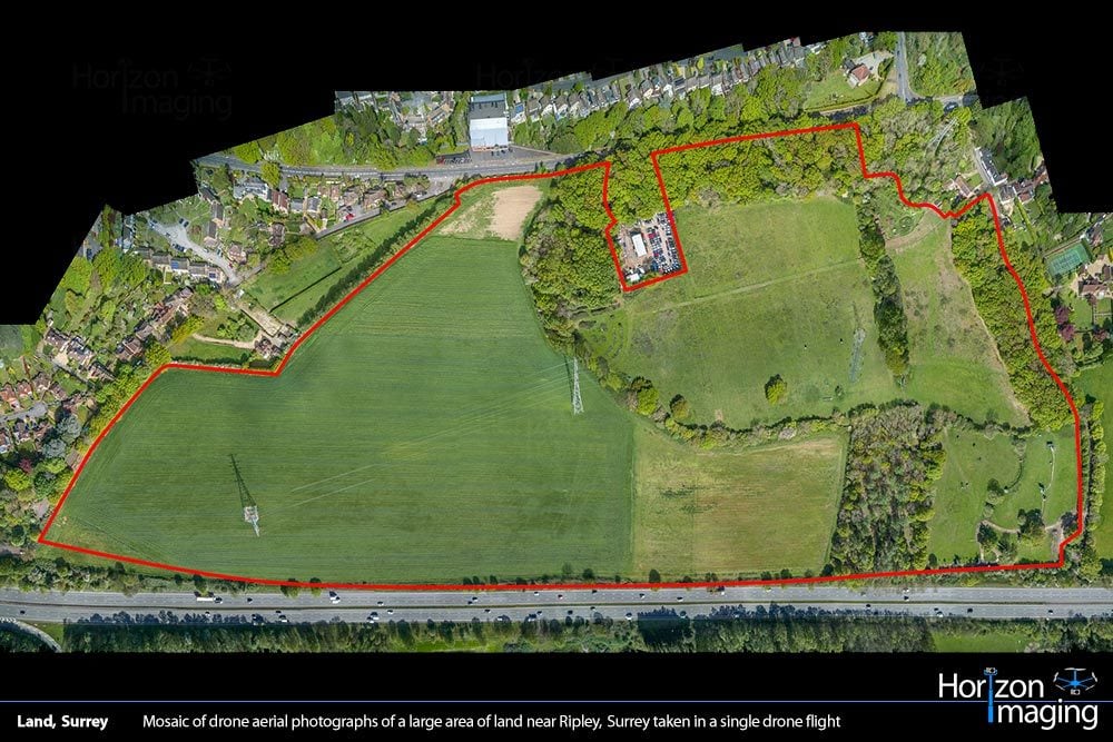
Plan-View Mosaic Aerial Photographs
Another clever use of image stitching allows us to create plan-view mosaic images of very large areas of land — areas far larger than could be captured in a single image.
By programming the drone to autonomously fly to a number of waypoints and take plan-view photographs at each, it’s possible to stitch together large 2D plan-view maps such as the one shown on the right. This image is comprised from some 38 plan-view drone aerial photographs.
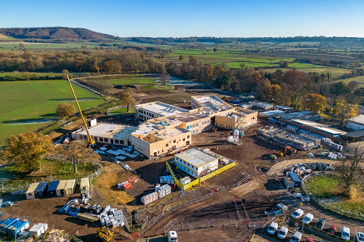
Potential usages of this type of mosaic image stitching include capturing and outlining plots of land for sale, capturing up-to-date plan-view imagery for masterplans, or capturing the evolution of a large-scale construction site.
Plan-View Mosaic Aerial Photographs
Another clever use of image stitching allows us to create plan-view mosaic images of very large areas of land — areas far larger than could be captured in a single image.
By programming the drone to autonomously fly to a number of waypoints and take plan-view photographs at each, it’s possible to stitch together large 2D plan-view maps such as the one shown on the right. This image is comprised from some 38 plan-view drone aerial photographs.
Potential usages of this type of mosaic image stitching include capturing and outlining plots of land for sale, capturing up-to-date plan-view imagery for masterplans, or capturing the evolution of a large-scale construction site.
What Do Our Clients Say?
If you haven’t used a Drone Photography company before, you’re in safe hands with Horizon Imaging. We have a track record of exceeding our clients’ expectations and providing excellent customer service from start to finish.
You can read feedback from some of our clients who have used our Drone Photography Services below, or you can browse through all 200+ of our glowing testimonials from across all our services on our dedicated Testimonials page.
TIP! Refresh the page to see three different testimonials!
“JOG Contractors Limited commissioned Horizon Imaging to provide some professional marketing photographs for our new website – from both the air and the ground. David was punctual and professional conformed to the site’s Health & Safety policies. David holds a CSCS card and provided a Risk assessment for his scope of works. We would not hesitate in recommending Horizon Imaging and look forward to working with David in the future.”
“Horizon Imaging has provided a range of photographic and filming services for Wates Developments including videos to support public consultations as well as high quality photographs of our joint venture projects. David is very friendly, easy to work with and you can rely on him to produce great results. We look forward to continuing to work with Horizon Imaging in the future.”
“Very pleased with the work that Horizon Imagery carried out for us. We were able to produce high quality brochures for our client by using Horizon to get excellent photographs of a property in a tricky spot!”
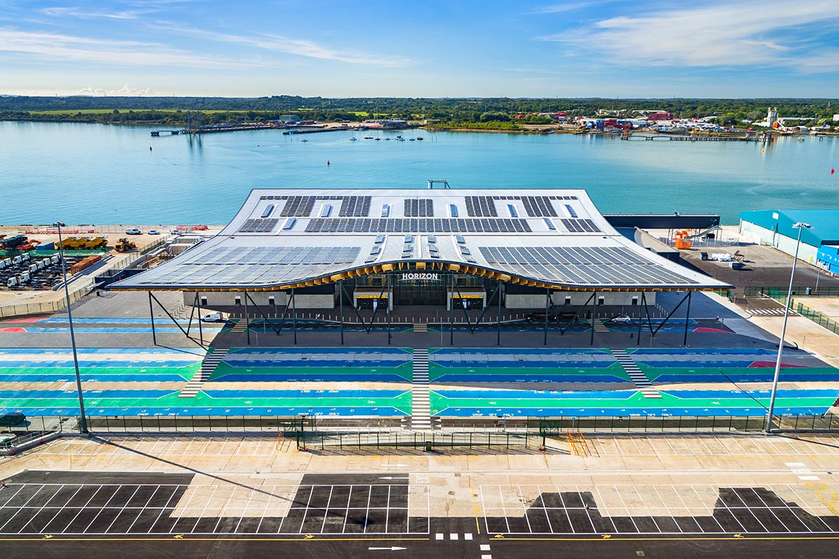
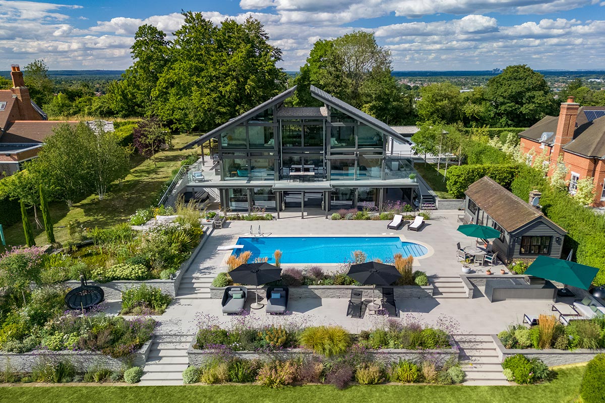
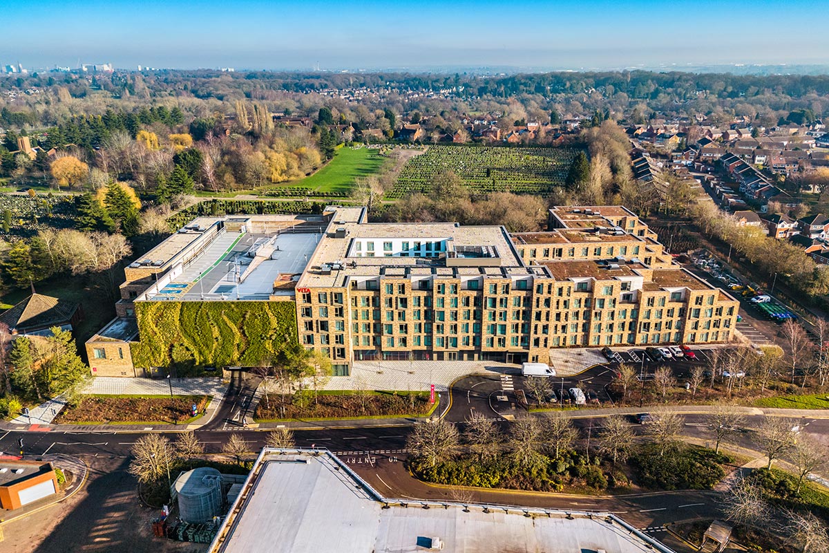
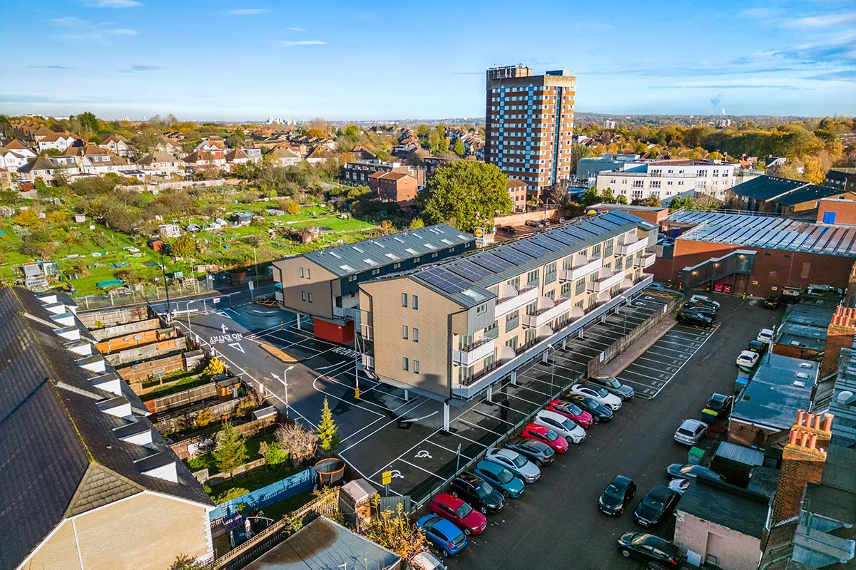
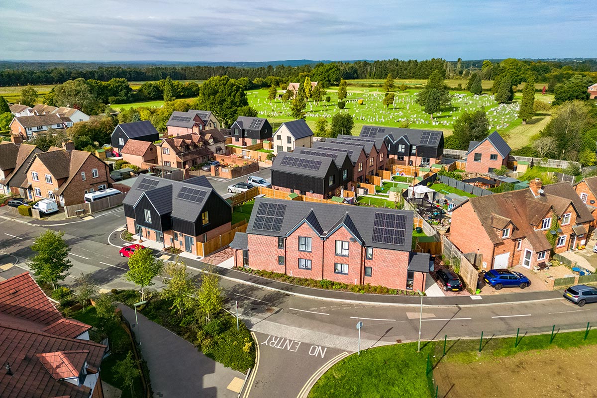
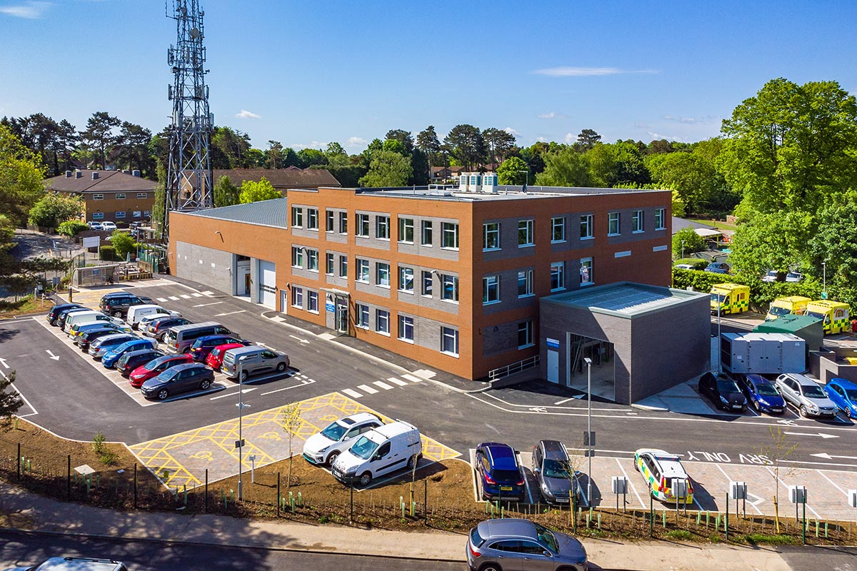
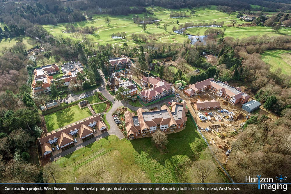
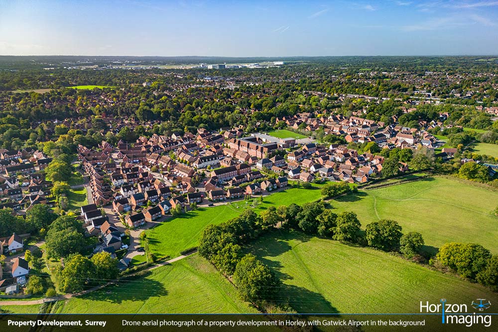
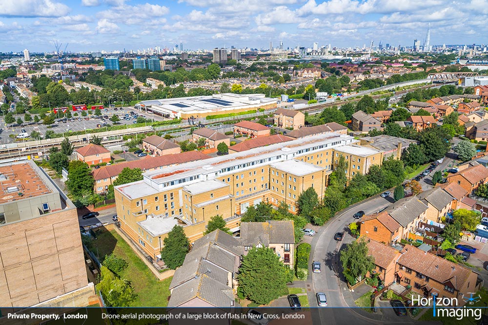
Drone Photography Sample Imagery
Intrigued by what you’ve seen and want to see some more examples of our Drone Photography work? Click on any of the images below to visit our Drone Photography Gallery:
Please feel free to get in touch with us, we'd be delighted to chat through your requirements with you!
Please feel free to get in touch with us, we’d be delighted to chat through your requirements with you!
Call us today on:
01483 610 535 or 07792 139 506
Or drop us an email on:
Or complete the form below and we will be in touch within 1-2 working days.
Thank you for your time and we look forward to hearing from you!