


Horizon Imaging was recently commissioned to take some aerial photographs to show how close a new housing development is to the sea-front in the pretty coastal village of Prinsted, Hampshire. Whilst the sea cannot easily be seen from the site itself, the developer, Junnell Homes, were keen to illustrate that the development was within easy walking distance of the harbour – and what better way to do this than with a drone aerial photograph!
Whilst planning the shoot, both the angle of the sun, the height of the tide, and the accessibility of the surrounding land had to be taken into consideration. There was only one area of land where the photographs could be taken from (some nearby farmland), the images had to be taken during the afternoon to avoid pointing the camera directly into the sun, and the shoot also had to coincide with high-tide when the harbour would look at its best
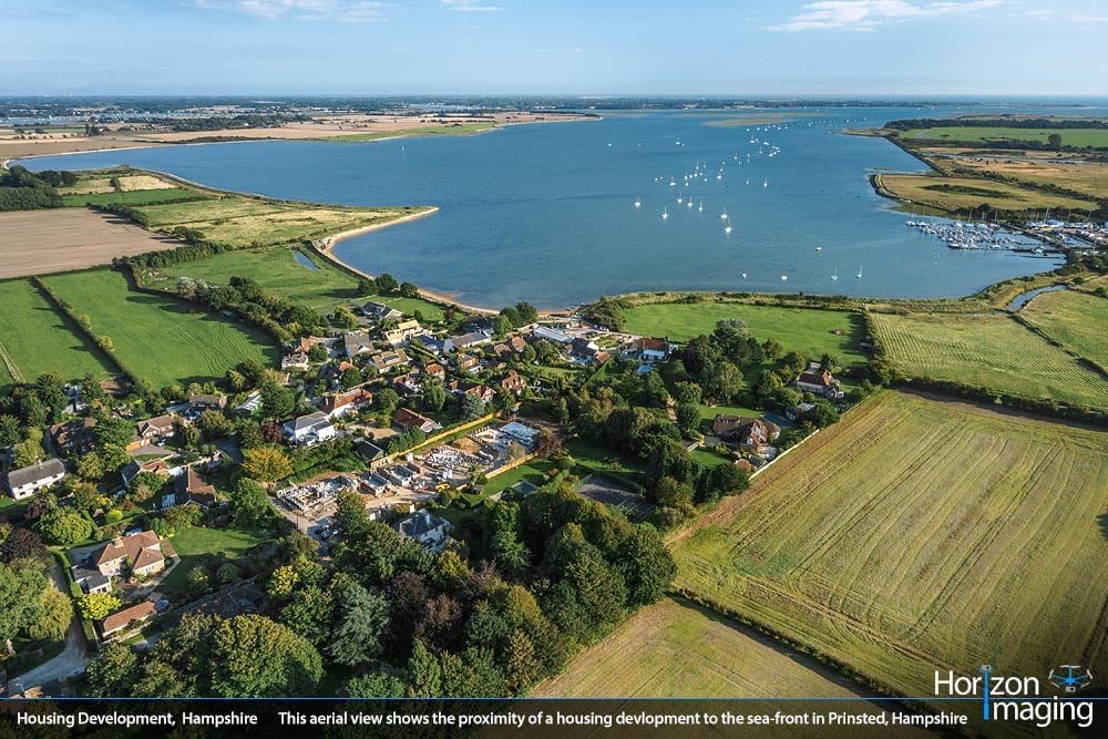
This aerial photograph of Prinsted, Hampshire, taken with our radio-controlled drone, clearly shows how close a new housing development (centre) is to the beautiful Chichester Harbour.
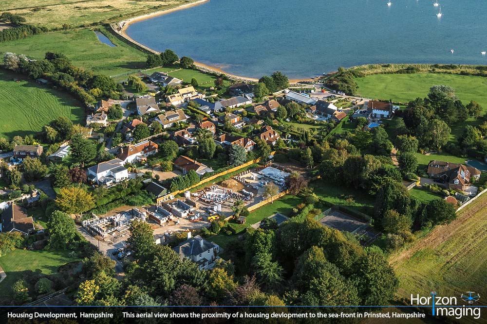
Another closer aerial view of the new Prinsted housing development shows how the Chichester Harbour sea-front is within easy walking distance
All these factors came together on a warm, sunny afternoon in mid-September, and the resulting images exceeded the expectations of the client, who recently sent us this kind testimonial:
“We commissioned Horizon Imaging to take an aerial photograph of our property development at Prinsted, Chichester Harbour. The brief was to capture the development in the context of the settlement of Prinsted nestling among the surrounding countryside and reaching out to the shore of Chichester Harbour beyond. David fully understood the brief and was both intelligent and resourceful in identifying the best site from which to fly the drone and then contacting neighbours for permission. The final images were superb and beyond expectation.”
As can be seen from the aerial photographs, the housing development is still under construction, but with the latest computer-generated imaging techniques, a model of the completed development will be superimposed onto the aerial photograph, allowing the development to be marketed before the building work has been completed.
Is your site’s location one of its biggest assets? Do you wish there was an easy and affordable way to illustrate how your site sits within the surrounding landscape? Drop us a line today to learn more about how our drone aerial photography services can help!